Category:Flooding of the Meuse (1926)
Jump to navigation
Jump to search
Nederlands: Afbeeldingen van de overstroming van de rivier de Maas vanaf 1 januari 1926 als gevolg van hoge waterstanden, waarbij in Nederland gebieden in de provincies Limburg, Noord-Brabant en Gelderland werden overstroomd.
| Upload media | |||||
| Instance of | |||||
|---|---|---|---|---|---|
| Location |
| ||||
| Point in time |
| ||||
| Start time |
| ||||
| End time |
| ||||
| |||||
Subcategories
This category has the following 2 subcategories, out of 2 total.
I
- Inondation Liège 1926 (14 F)
M
- 1926 flood in Maastricht (28 F)
Media in category "Flooding of the Meuse (1926)"
The following 16 files are in this category, out of 16 total.
-
 Alverna (Wijchen) monument watersnood 1926, Graafseweg.JPG 2,727 × 3,636; 3.57 MB
-
 Cuyk (Cuijk) Nederland, SFA008003247.jpg 3,555 × 2,561; 1.18 MB
-

-
 Cuyk (Nederland), SFA008003246.jpg 3,555 × 2,561; 898 KB
-
 Cuyk (Nederland), SFA008003249.jpg 3,530 × 2,539; 1,001 KB
-

-

-
 Inzamelacties, SFA002009690.jpg 3,612 × 2,449; 1.53 MB
-

-
 Namur distribution vivres et courrier.jpg 2,096 × 3,220; 1.14 MB
-
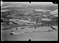
 NIMH - 2011 - 0140 - Aerial photograph of Gennep, The Netherlands - 1920 - 1940.jpg 3,500 × 2,564; 1.9 MB
-
 NIMH - 2011 - 0141 - Aerial photograph of Ottersum, The Netherlands - 1920 - 1940.jpg 3,500 × 2,564; 1.84 MB
-
 NIMH - 2011 - 0153 - Aerial photograph of Nederasselt, The Netherlands - 1920 - 1940.jpg 3,500 × 2,553; 2.12 MB
-
Overstroming-514491.ogv 4 min 34 s, 768 × 576; 58.08 MB
-

-
Watersnoodcollecte-523532.ogv 3 min 35 s, 768 × 576; 42.41 MB
_monument_watersnood_1926,_Graafseweg.JPG)
_Nederland,_SFA008003247.jpg)
_Overstroming_door_een_dijkdoorbraak_in_Cuyk_Op_de_plek_waar_de_dijk_is,_SFA008003212.jpg)
,_SFA008003246.jpg)
,_SFA008003249.jpg)


